


Thunderstorm, medium rainfall, possibly for the next 2 hours in areas of Delhi: IMD
Key sentence:
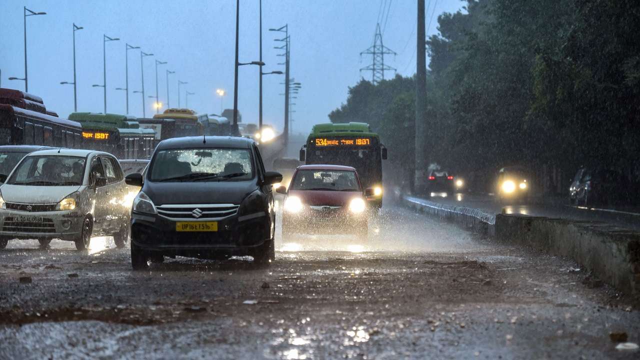
- On Monday, the (IMD) said that many areas in Delhi are likely to encounter thunderstorms and light showers in the next two hours.
- Delhi received 39.9mm of rain around 8.30 am on Saturday as well as 2.30 pm on Sunday.
- The fresh northerly-northwesterly wind is most likely to set in well over plains of northwest India following cessation of the wet spell.
The Indian Meteorological Department (IMD) said that many areas in Delhi are likely to encounter thunderstorms and light showers in the next two hours.
“The weather department stated, “Thunderstorms with light to medium intensity rain were likely to occur over and adjacent areas of isolated areas of West, North-West as well as North Delhi over the next 2 hours.
As per the IMD scientists:
Delhi received 39.9mm of rain around 8.30 am on Saturday as well as 2.30 pm on Sunday, which is much higher than the normal rain quota of 21.7mm for all of January. According to IMD scientists, more rain is forecast by Tuesday, as well as hailstorms and thunderstorms.

An active western disturbance is lying over central Pakistan:
With its induced cyclonic circulation over southwest Rajasthan, an active western disturbance lies as middle as well as an upper cyclonic circulation over central Pakistan.
From north Punjab to its northeast Arabian Sea, a north-south region of wind confluence is also reported, with a heavy interaction between southwesterly winds and moist southeasterly lower levels.
The conditions are likely to persist till January 5:
These conditions are likely to continue until January 5 because moderate to heavy rain with thunderstorms, lightning, and hailstorms at isolated locations in northwest India is expected to continue until the night of January 5 with peak activity over the plains on January 3 and 4 (Punjab, Haryana, Chandigarh including Delhi, West Uttar Pradesh, and also north Rajasthan) as well as on January 4 and 5 and over the western Himalayan river (Jammu & Kashmir, Muzaffarabad, Ladakh, Gilgit-Baltistan, Himachal Pradesh, and Uttarakhand).
As IMD stated previously:
The fresh northerly-northwesterly wind is most likely to set in well over plains of northwest India following cessation of the wet spell, triggering cold wave to extreme cold wave conditions at isolated locations over Punjab, Haryana through north Rajasthan from January 7 onwards, the IMD had previously said.
Meanwhile, with thunderstorms and lightning, many northwest India regions continue to receive widespread and heavy rain.
Severe rain over Alwar, Bharatpur, Tizara, Kotputli, Deeg, in Rajasthan, Khurja, Anupshahar, Aligarh, Jattari, Iglas, Khair, Sahaswan, Hathras, Barsana, Gabbana, Chandausi, Bhajoi, Sambhal throughout UP, Palwal, Hodal, Aurangabad, as well as Nuh in Haryana, had been predicted by the Met Department.