Key points:
- By Thursday evening, Cyclone Burevi had weakened into a deep recession over the Gulf of Mannar, near Pamban.
- The wind speed has decreased, so we do not expect harm to happen.
- It passed the narrow strip of the Palk Strait and the Pamban region and as a deep depression, would cross Tamil Nadu.
- The deep depression is likely to travel west-southwestward and pass through the districts of Ramanathapuram and Thoothukudi.
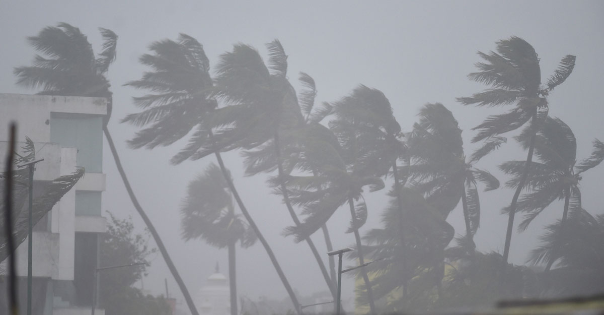
By Thursday evening, Cyclone Burevi had weakened into a deep recession over the Gulf of Mannar, near Pamban. It is projected to cross the Tamil Nadu districts of Ramanathapuram and Thoothukudi on Friday morning with wind speeds ranging from 50-60 kmph to 70 kmph, carrying heavy rain to southern Tamil Nadu as well as parts of southern Kerala.
As M Mohapatra IMD general director stated:
However, there is a risk that Burevi will emerge and re-intensify in the Arabian Sea, scientists stated. With its deterioration into a deep depression, fears about widespread damage or catastrophe from a cyclone in the south of the state of Kerala have been put to rest.
The wind speed has decreased, so we do not expect harm to happen. But there are possibilities that the depression in the Arabian Sea will merge. We can’t tell instantly what its track or strength is going to be.
We can make some predictions until it passes over the Arabian Sea. The track of Burevi (the Bay of Bengal to the Arabian Sea) is not normal, although it may not be the first event,’ said M Mohapatra, general director, Meteorological Department of India (IMD).
In charge of cyclones at IMD Sunitha Devi stated:
As a cyclonic storm with such a wind speed of 80-90 kmph raging to 100 kmph, scientists are also fascinated by Burevi’s track that made landfall over Sri Lanka near north of Trincomalee between 10.30 to 11.30 pm on Wednesday.
It passed the narrow strip of the Palk Strait and the Pamban region and as a deep depression, would cross Tamil Nadu.
I can’t tell right away that we’re seeing this cyclone track moving over Sri Lanka and India for the first time, but I have no recollection of such a track.
Some models also suggest that the depression would manifest in a day or two in the Arabian Sea. It is difficult to remove its re-intensification from a depression,’ said Sunitha Devi, head of cyclones at IMD.
On Thursday night, Burevi lay over the gulf of Mannar near the coast of Ramanathapuram district. The wind speed associated with this is about 55-65 kmph to 75 kmph.
The deep depression is likely to travel west-southwestward and pass through the districts of Ramanathapuram and Thoothukudi. Later on Friday, it is also very likely to further degrade into a depression (wind speed 40-50kmph gusting to 60 kmph).