Monsoon Intensifies: Satellite Images Signal Heavier Rain Ahead for Mumbai
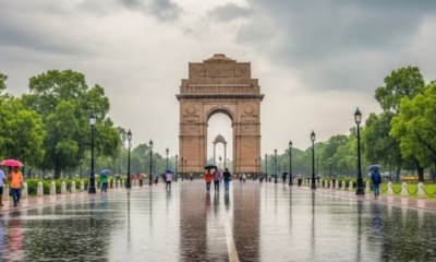
Mumbai, May 26 — The Southwest Monsoon continues its rapid and widespread advance across India, bringing intensified rainfall and raising alerts for several regions, including Mumbai and broader Maharashtra.
The India Meteorological Department (IMD) confirmed on Sunday that the monsoon has progressed deeper into several key regions. According to satellite imagery from INSAT-3DS, dense cloud formations are now dominating the skies over Maharashtra and coastal Karnataka, signaling a likely intensification of rainfall over the next few days.
As of May 26, the IMD reports that the monsoon has advanced into additional parts of the central Arabian Sea, larger portions of Maharashtra—including Mumbai and Pune—and much of Karnataka, including Bengaluru. The rain-bearing system has also reached remaining areas of Tamil Nadu, parts of Telangana and Andhra Pradesh, and broader stretches of the westcentral and North Bay of Bengal.
In the Northeast, the monsoon has swept across all of Tripura, Manipur, Nagaland, and Arunachal Pradesh. It has also reached the remaining regions of Mizoram and parts of Assam and Meghalaya, marking a significant stride in its northward expansion.
The current Northern Limit of Monsoon (NLM) now spans from Mumbai through Pune, Sholapur, Kalaburagi, Mahbubnagar, Kavali, Agartala, and Golpara, extending up to latitude 28.5°N and longitude 89°E. This trajectory underscores the monsoon’s swift advance across the subcontinent.
Meteorologists note that conditions are highly favourable for continued monsoon progression over the next three days. IMD forecasts indicate that rains will extend further into the central Arabian Sea, additional parts of Maharashtra and Karnataka, and more regions of Telangana and Andhra Pradesh. The rest of the northeastern states, as well as parts of Sub-Himalayan West Bengal and Sikkim, are also expected to see monsoon onset soon.
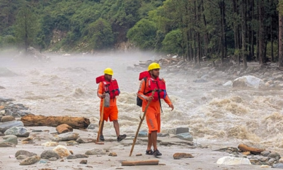
For Mumbai, the situation is already proving challenging. Early monsoon showers have caused waterlogging and traffic disruptions in multiple areas. With more intense spells predicted, local authorities are advising residents to remain vigilant, especially in low-lying zones prone to flooding.
The role of satellite technology, particularly data from INSAT-3DS, has become increasingly vital in tracking monsoon dynamics. Real-time imagery is helping meteorologists and disaster management teams anticipate weather shifts and coordinate timely responses.
As the monsoon season sets in with force, regions in its path—especially dense urban centers like Mumbai—must prepare for heavier rainfall, potential flooding, and associated disruptions in the days ahead.
Let me know if you’d like a version tailored for a specific publication, platform, or tone (e.g., more scientific, more informal, etc.).
IT.