As Farmers adapt to monitoring systems, new technology seeks to uncover the true scale of crop residue fires.
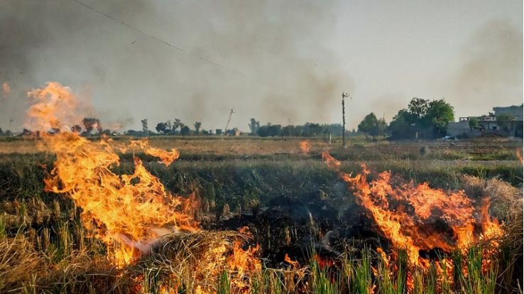
Tracking stubble burning in northern India is becoming increasingly complex as farmers find ways to avoid traditional satellite surveillance. While authorities have relied on satellite imagery for years to monitor crop residue fires, experts now believe many incidents may be escaping detection.
The situation mirrors a lesson long understood in space surveillance: satellites can only observe what happens when they are overhead. Farmers in Punjab and Haryana have reportedly become aware of these observation patterns and are timing field burnings during periods when monitoring satellites are not passing over their locations.
This growing concern has prompted the International Forum for Environment, Sustainability and Technology (iFOREST) to launch a new platform called Fire Watch. The initiative aims to provide a more comprehensive understanding of stubble-burning activities by combining information from multiple satellite systems, rather than relying solely on conventional fire counts.
Over the past few years, official records have shown a sharp decline in detected farm fires. The reduction is often credited to stricter enforcement, financial penalties, awareness campaigns, and government support for alternative crop-residue management practices. However, environmental experts argue that lower recorded numbers may not reflect the full picture, as many fires could occur outside satellite observation windows.
Traditional monitoring depends mainly on polar-orbiting satellites that pass over the same region only at fixed times during the day. As a result, fires that start and end between those passes can go unnoticed. Recognizing this limitation, Fire Watch incorporates data from additional satellite networks, including geostationary satellites that continuously monitor the same area and capture images at frequent intervals.
The platform also examines satellite images taken before and after the burning season to estimate the actual area affected by fires. Experts believe this approach offers a more accurate assessment than counting individual fire incidents alone. Areas with similar fire counts may experience vastly different levels of agricultural damage, making burnt-area analysis an important part of environmental monitoring.
The issue has also drawn national attention. Policymakers have highlighted India’s dependence on foreign satellite systems for fire detection and called for stronger domestic capabilities. The country’s advanced Earth-observation satellites could improve continuous monitoring and reduce blind spots in surveillance.
Even so, scientists point out that avoiding detection during a fire is becoming harder over time. Although active flames may be missed, the burnt scars left on agricultural land remain visible through high-resolution satellite imagery. As monitoring technology evolves, authorities and farmers find themselves engaged in an ongoing race between observation and evasion, with significant implications for air quality and environmental management.